Understanding how shrimp farming expansion is transforming coastal landscapes, aquatic environments, and ecosystem services in Bangladesh.
Coastal shrimp aquaculture has become an important part of Bangladesh’s fisheries economy, supporting export earnings, employment, and the livelihoods of thousands of coastal households. The southwestern coastal districts, particularly Khulna, Satkhira, and Bagerhat, are major shrimp-producing regions where farming activities are closely connected with rivers, canals, agricultural lands, and mangrove-associated ecosystems.
However, the rapid expansion of shrimp farming has raised concerns about its long-term environmental footprint. Conversion of agricultural land into shrimp ponds, changes in water exchange practices, increasing salinity, and pressure on natural vegetation may affect the ecological condition of surrounding coastal environments. Understanding these changes is essential for ensuring that shrimp production remains economically productive without compromising the natural resources that support it.
Why is the environmental footprint of shrimp aquaculture attracting attention?
The environmental impacts of shrimp aquaculture extend beyond individual farming areas. Shrimp ponds are often connected to nearby rivers and canals through water-intake and discharge systems. Consequently, farm management practices may influence the movement of nutrients, organic matter, suspended solids, and other substances into surrounding aquatic environments.
One major concern is the expansion of shrimp farming into agricultural landscapes. A study by Ahmed and Ambinakudige (2024) found that aquaculture areas in selected southwestern coastal regions of Bangladesh increased from 391.37 km² in 1990 to 739.93 km² in 2022, while agricultural land declined by approximately 321.83 km².
Salinity is another important environmental concern. The introduction and management of brackish water in shrimp farming areas may influence surrounding soils and water systems, particularly where agricultural fields and shrimp ponds are closely connected. Morshed et al. (2020) found that soil salinity increased in Satkhira over time and that paddy plots located closer to shrimp ponds generally experienced higher salinity levels.
These changes highlight the need to evaluate shrimp aquaculture as part of a wider coastal ecosystem rather than considering production performance alone.
What do recent studies mean for coastal Bangladesh?
Research from southwestern Bangladesh indicates that shrimp aquaculture expansion is associated with substantial changes in land-use patterns and coastal livelihoods.
Gazi et al. (2023) used satellite-based land-use analysis to investigate changes in the southwestern coastal districts between 1990 and 2020. Their findings indicated that approximately 1,500 km² of land was converted into shrimp farming areas during the study period.
Similarly, Ahmed and Ambinakudige (2024) combined remote sensing analysis with farmers’ perceptions to investigate the relationship between shrimp farming, agricultural production, and food security. Their findings highlighted the expansion of aquaculture areas and the reduction of agricultural land in the study regions.
The relationship between shrimp farming and mangrove ecosystems also requires attention. Mangroves provide essential ecosystem services, including coastal protection, carbon storage, nursery habitats, and support for aquatic biodiversity. Changes in coastal land use may place pressure on mangrove-associated habitats, although the extent and causes of mangrove loss must be assessed independently rather than automatically attributing every forest-cover change to shrimp farming.
These studies demonstrate why long-term environmental monitoring is important for understanding the combined effects of aquaculture expansion, land transformation, and coastal environmental change.
How can the environmental footprint of shrimp aquaculture be assessed?
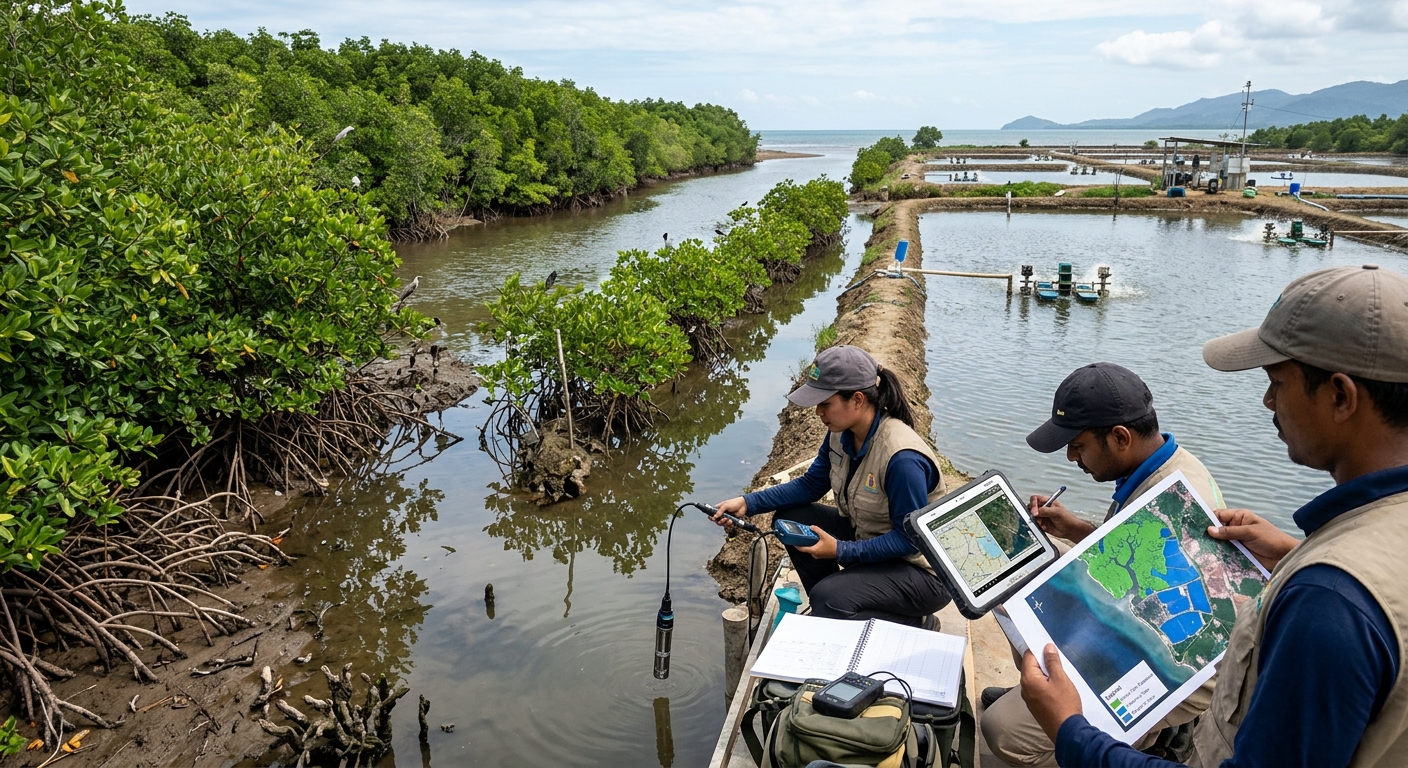
An integrated research approach combining satellite remote sensing, GIS-based land-use analysis, and field-level water-quality monitoring can provide a broader understanding of environmental changes associated with shrimp farming.
1. Monitoring shrimp farm expansion
Multi-temporal satellite imagery can identify changes in shrimp farming areas and surrounding land-cover types over several decades.
Potential datasets include Landsat 5, 7, 8, and 9 and Sentinel-2 imagery. Google Earth Engine can support large-scale image processing and land-use classification.
The analysis can identify changes in shrimp ponds, agricultural land, mangrove vegetation, settlements, and other land-cover categories. Comparing different years can reveal where shrimp farming has expanded and which land-cover types have been replaced.
2. Assessing adjacent river and canal water quality
Water-quality monitoring can be conducted at selected locations near shrimp farms, including farm inlets, discharge points, and connected rivers or canals.
Important parameters may include:
- Dissolved oxygen (DO)
- pH and water temperature
- Salinity and electrical conductivity (EC)
- Turbidity and total suspended solids (TSS)
- Ammonia, nitrate, and phosphate
- Biochemical oxygen demand (BOD)
Seasonal sampling can help identify variations associated with rainfall, tidal conditions, freshwater availability, and aquaculture activities.
3. Evaluating mangrove cover and vegetation changes
Satellite-derived vegetation indices, such as NDVI and EVI, can help monitor vegetation conditions and identify changes in mangrove-associated landscapes.
Historical satellite images can also be used to investigate vegetation loss, fragmentation, and changes in the spatial relationship between shrimp farms and mangrove boundaries.
4. Investigating salinity and ecosystem services
Field measurements of water and soil salinity can be combined with spatial analysis to understand salinity patterns across shrimp-producing landscapes.
The study can also examine changes in ecosystem services, including fisheries resources, agricultural productivity, carbon storage, coastal protection, and habitat availability.
This integrated approach would help distinguish between observed environmental changes and the specific contribution of shrimp aquaculture.
How can the findings support sustainable shrimp aquaculture planning?
The findings of such an assessment could provide practical information for improving coastal aquaculture management.
A GIS-based environmental suitability map could help identify areas appropriate for shrimp farming while considering agricultural land, mangrove habitats, water availability, and existing environmental conditions.
Regular monitoring of farm discharge and adjacent water bodies could support better water-quality management. Appropriate effluent treatment, settling ponds, controlled water exchange, and responsible feed management may help reduce environmental pressure.
Mangrove conservation and restoration should also be incorporated into coastal planning. Protecting ecologically sensitive areas and maintaining natural connections between rivers, canals, and mangrove habitats are important considerations for sustainable aquaculture development.
By combining satellite observations with field measurements, environmental managers could identify vulnerable locations and prioritize areas requiring monitoring or management interventions.
Why does this research matter?
Shrimp aquaculture contributes significantly to Bangladesh’s fisheries economy, but its long-term productivity depends on healthy coastal ecosystems and responsible resource management.
Understanding the relationship between shrimp farm expansion, water quality, land-use change, salinity, and ecosystem services can help identify environmental risks and support evidence-based planning.
This research could benefit fisheries scientists, aquaculture producers, environmental managers, coastal planners, and policymakers by providing a more comprehensive understanding of the environmental consequences of shrimp farming.
Ultimately, sustainable shrimp aquaculture requires a balance between economic development, environmental protection, and the long-term well-being of coastal communities.
Looking ahead
Future research could focus on developing a decadal environmental assessment of selected shrimp-producing areas in Khulna, Satkhira, and Bagerhat using Landsat and Sentinel satellite imagery, GIS-based land-use analysis, and seasonal field-level water-quality measurements.
Combining these datasets could reveal how shrimp farming areas have changed over time, how adjacent rivers and canals respond to environmental pressures, and how land-use transformation relates to salinity and ecosystem services.
The ultimate goal is to support sustainable shrimp aquaculture planning in Bangladesh through scientific evidence, spatial monitoring, and environmentally responsible management practices.
References
- Ahmed, Z., & Ambinakudige, S. (2024). How does shrimp farming impact agricultural production and food security in coastal Bangladesh? Evidence from farmer perception and remote sensing approach. Ocean & Coastal Management, 255, 107241. https://doi.org/10.1016/j.ocecoaman.2024.107241
- Gazi, M. Y., Haque, M. I. M., Alam, M. Z., & Uddin, M. M. (2023). Spatiotemporal landuse dynamics driven by socioeconomic context in the southwestern coastal districts of Bangladesh. Ocean & Coastal Management, 241, 106859. https://doi.org/10.1016/j.ocecoaman.2023.106859
- Morshed, M. M., Islam, M. S., Lohano, H. D., & Shyamsundar, P. (2020). Production externalities of shrimp aquaculture on paddy farming in coastal Bangladesh. Agricultural Water Management, 238, 106213. https://doi.org/10.1016/j.agwat.2020.106213
- Mamun, A. A. (2020). Influence of salinity on aquaculture species richness in the mangrove-river connected zone of southwest Bangladesh. AACL Bioflux, 13(4), 2180–2195.
- Jamal, M. R. (2024). Blue grabbing of the green crop fields: A development conundrum in southwest coastal Bangladesh. Land Use Policy, 141, 107161. https://doi.org/10.1016/j.landusepol.2024.107161